Download Now
RTOPO 2.9
Download Now
See full specifications
Publisher's descriptionOS Support: Win98, WinOther, Win2000, WinXP, Win7 x32, Win7 x64, Windows 8, Win Vista
Version 2.9
Size 0.56Mb
Hits: 619 visitors
Downloads: 280
License: Shareware
Price: 64 USD (Buy Now)
Date added: 14 Oct 2013
Last Update: 22 Jun 2013
Simple, powerful and inexpensive CAD software for surveying. For only 48 EUR (24 EUR the second licence), you can do triangulation, isolines, color-filled contour maps, sections, intersections, VOLUME and much more. You can process hundreds of thousands of points or triangles, even on less powerful PCs.
Through its own CAD system (called RCAD), specialized for 3D and for a large number of entities, you can:
-load and draw a file of points having the format: Number X Y Z Code; the drawing is made by POINT,3DPOLY,SPLINE or BLOCK entities, according to a modifiable library of codes
-edit interactively the points; you can modify the coordinates, the code and the position (in 3DPOLY or SPLINE)
-triangulate the points on a convex hull or between an external contour and possibly more interior contours
-do isolines (contour lines) and color-filled contour map
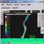
-do cross SECTIONS and longitudinal profile
-do the projection of several PLine entities over a triangulation
-do the conversion of a TRIANGULATION to a regular grid of points
-do the conversion of the existing isolines resulting from maps in points and then in a triangulation
-represent the geological_stratification resulting from drilling
-calculate 3D area, center of gravity and the volume between 2 triangulations or between a triangulation and a plan
-intersect and divide two triangulations (or two sets of 3dmesh and 3dface entities) or a triangulation by a horizontal plan
-interpolate a set of 3DFACE entities, using quartic triangular patches (G1 continuity)
-transform a drawing containing entities as PLine (3dpoly), Line, Block and Text, in points having codes and then in a triangulation.
RCAD CAD system, distributed together with RTOPO, provides OpenGL real-time orbit, pan,zoom, shading, lighting and motion path ANIMATION RCAD is similar with other popular CAD systems and can load and save DXF files. It has entries in the command text area, graphics area, menus and toolbars and can run scripts.
Available Translations: None
Popular related
Powerful 3D/image/video files organizer/viewer/editor (+80 formats supported)
TOPOGRAPHY | XYZ points | TRIANGULATION | ISOLINES | SECTIONS | Projection | quartic | DTM | Digital Terrain Model | TIN | Triangular Irregular Network | CAD | DXF | OPENGL | AUTOCAD | IntelliCAD |
 suggest to a friend
 report error
 add to my alerts